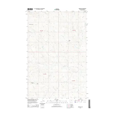
2014 Map of Jordan NE
USGS Topo · Published 2014About this map
White Horse Divide serves as a prominent topographic spine in this portion of Garfield County, separating the drainages that carve through the high plains of Eastern Montana. The landscape is defined by an intricate network of seasonal watercourses and coulees, including the winding Frazier Cr and White Horse Cr. In the northeastern quadrant, the Piney Buttes rise above the surrounding terrain, providing significant landmarks in an area dominated by cattle ranching and large-scale land sections. Modern infrastructure is represented by the north-south corridor of MT-341, which provides the primary access through this sparsely populated region. For those tracing the geography of the Missouri River breaks or the expansive rangelands north of Jordan, the map details many local landmarks such as Van Coulten Coulee and Oliver Coulee.
Find a feature on this map
14 named features on this map. Tap any name to fly to it.
Don’t see what you’re looking for? This feature index may not catch every label — zoom into the map to look around manually.
Map Details
Editions of this 2014 Jordan NE Map
This is the sole edition of this map. No revisions or reprints were ever made.
Other maps of this area

1954 · Jordan
USGS Topo · 1:250,000

1956 · Jordan
USGS Topo · 1:250,000

1958 · Jordan
USGS Topo · 1:250,000

1958 · Maloney Hill
USGS Topo · 1:62,500

1964 · Jordan
USGS Topo · 1:250,000

1964 · Jordan SE
USGS Topo · 1:24,000

1964 · Jordan NE
USGS Topo · 1:24,000

1964 · Bateman Coulee
USGS Topo · 1:24,000

1964 · Black John Coulee
USGS Topo · 1:24,000

1964 · Jordan NW
USGS Topo · 1:24,000