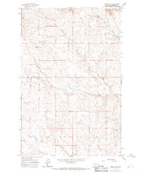
1964 Map of Jordan NW
USGS Topo · Published 1967About this map
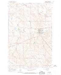
White Horse Divide dominates the northeastern corner of this Garfield County landscape, serving as a primary topographic feature for a network of drainages that define the local hydrology. This 1964 survey, field-checked by the U.S. Geological Survey and USC&GS, captures the area's transition into the Missouri River breaks ecosystem. The terrain is deeply incised by seasonal watercourses including Hogs Back Creek, Bear Creek, and Frazier Creek, which follow the natural contours of the high plains toward the north and south. Human activity in this remote stretch of Montana is sparse, marked primarily by the presence of a Well in the central sections and a Gravel Pit to the southeast, reflecting a landscape focused on ranching and essential infrastructure rather than concentrated settlement.
Find a feature on this map
8 named features on this map. Tap any name to fly to it.
Don’t see what you’re looking for? This feature index may not catch every label — zoom into the map to look around manually.
Map Details
Editions of this 1964 Jordan NW Map
This is the sole edition of this map. No revisions or reprints were ever made.
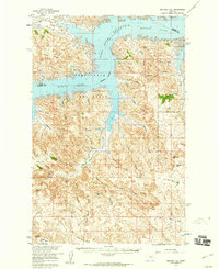
Other maps of this area

1954 · Jordan
USGS Topo · 1:250,000

1956 · Jordan
USGS Topo · 1:250,000

1958 · Jordan
USGS Topo · 1:250,000
1958 · Maloney Hill
USGS Topo · 1:62,500

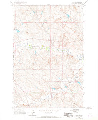
1964 · Jordan
USGS Topo · 1:250,000
1964 · Jordan SE
USGS Topo · 1:24,000
1964 · Jordan NE
USGS Topo · 1:24,000
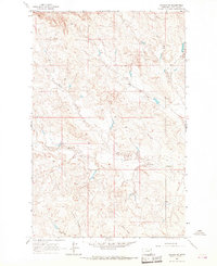
1964 · Jordan
USGS Topo · 1:24,000
1971 · Trumbo Ranch
USGS Topo · 1:24,000
1978 · Fort Peck Lake West
USGS Topo · 1:100,000