
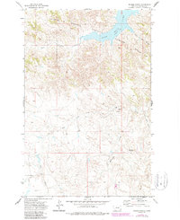
1971 Map of Trumbo Ranch
USGS Topo · Published 1974About this map
Trumbo Ranch serves as the namesake focal point of this remote Garfield County landscape, situated within the expansive Charles M Russell National Wildlife Range. The northern edge of the sheet is defined by the irregular shoreline of Fort Peck Lake, where the high-water mark meets a complex network of coulees and breaks. The terrain is deeply incised by drainages such as Snow Creek, Hell Creek, and Cottonwood Creek, which flow through the arid Missouri River breaks. The topographic detail captures a transition from high prairie plateaus down toward the reservoir, punctuated by landmarks like Brownie Butte. This 1970s survey illustrates a region largely dedicated to wildlife conservation and ranching, reflecting the spare settlement patterns and rugged geography characteristic of the Big Dry country.
Find a feature on this map
12 named features on this map. Tap any name to fly to it.
Don’t see what you’re looking for? This feature index may not catch every label — zoom into the map to look around manually.
Map Details
Editions of this 1971 Trumbo Ranch Map
2 editions found
Other maps of this area

1954 · Jordan
USGS Topo · 1:250,000

1956 · Jordan
USGS Topo · 1:250,000

1958 · Jordan
USGS Topo · 1:250,000

1958 · Maloney Hill
USGS Topo · 1:62,500

1964 · Jordan
USGS Topo · 1:250,000

1964 · Jordan NW
USGS Topo · 1:24,000

1971 · Hell Hollow
USGS Topo · 1:24,000

1971 · Wagon Coulee
USGS Topo · 1:24,000

1971 · Harper Camp
USGS Topo · 1:24,000

1978 · Fort Peck Lake West
USGS Topo · 1:100,000