
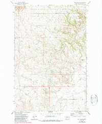
1971 Map of Hell Hollow
USGS Topo · Published 1974About this map
The Charles M Russell National Wildlife Range defines the northern reaches of this Garfield County landscape, showcasing the deeply dissected breaks of the Missouri River country. The topography is characterized by intricate drainage networks, including the meandering path of Snow Creek and the distinctively named South Fork Hell Hollow. These seasonal watercourses reveal a land shaped by erosion, where elevation changes are marked by features such as Baldy Butte.
Find a feature on this map
7 named features on this map. Tap any name to fly to it.
Don’t see what you’re looking for? This feature index may not catch every label — zoom into the map to look around manually.
Map Details
Editions of this 1971 Hell Hollow Map
2 editions found
Other maps of this area

1954 · Jordan
USGS Topo · 1:250,000

1956 · Jordan
USGS Topo · 1:250,000

1958 · Jordan
USGS Topo · 1:250,000

1964 · Jordan
USGS Topo · 1:250,000

1971 · Trumbo Ranch
USGS Topo · 1:24,000

1971 · Wolfe Coulee
USGS Topo · 1:24,000

1971 · Wagon Coulee
USGS Topo · 1:24,000

1971 · Harper Camp
USGS Topo · 1:24,000

1971 · Chalk Butte
USGS Topo · 1:24,000

1978 · Fort Peck Lake West
USGS Topo · 1:100,000