
1971 Map of Wolfe Coulee
USGS Topo · Published 1974About this map
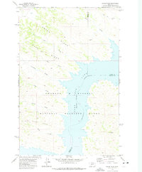
Fort Peck Lake dominates this landscape on the boundary between Valley and Garfield counties, showing the intricate, many-fingered shoreline created by the impoundment of the Missouri River. The territory within the Charles M Russell National Wildlife Range is defined by a complex network of drainages and coulees that cut through the breaks, illustrating the highly eroded terrain typical of the northern Missouri River valley. The map details numerous named drainages such as Wolfe Coulee, Thoeny Coulee, and Carney Coulee to the north, while the southern portion is marked by the course of Billy Creek and Billy Coulee. This 1971 field-checked survey provides an essential view of the hydrologic patterns and topography of this protected region before later shifts in management and shoreline levels.
Find a feature on this map
14 named features on this map. Tap any name to fly to it.
Don’t see what you’re looking for? This feature index may not catch every label — zoom into the map to look around manually.
Map Details
Editions of this 1971 Wolfe Coulee Map
This is the sole edition of this map. No revisions or reprints were ever made.
Other maps of this area

1954 · Jordan
USGS Topo · 1:250,000

1956 · Jordan
USGS Topo · 1:250,000

1958 · Jordan
USGS Topo · 1:250,000

1964 · Jordan
USGS Topo · 1:250,000

1971 · Hell Hollow
USGS Topo · 1:24,000

1971 · Wagon Coulee
USGS Topo · 1:24,000

1971 · Sawmill Creek
USGS Topo · 1:24,000

1971 · Chalk Butte
USGS Topo · 1:24,000
1971 · Swede Ridge
USGS Topo · 1:24,000
1973 · Gibson Coulee
USGS Topo · 1:24,000