
1971 Map of Sawmill Creek
USGS Topo · Published 1974About this map
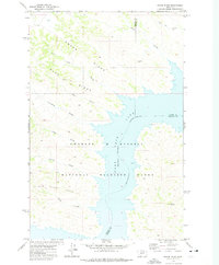
Fort Peck Lake and the Missouri River dominate the northern landscape of this Garfield County quadrangle, defining the boundary with Phillips County. Much of the terrain is protected within the Charles M Russell National Wildlife Range, showcasing a complex network of drainages including Big Coulee Creek and the branching system of North Sawmill Creek, Sawmill Creek, and South Sawmill Creek. The map documents a sparsely populated ranching environment where human presence is marked by isolated landmarks like the Wilson Ranch and a remote Jeep Trail winding through the eastern hills near Seven Blackfoot Creek. This 1971 survey illustrates the intersection of federal conservation lands and private Montana ranching history, capturing the area's essential hydrology and localized water sources like Spring Well.
Find a feature on this map
12 named features on this map. Tap any name to fly to it.
Don’t see what you’re looking for? This feature index may not catch every label — zoom into the map to look around manually.
Map Details
Editions of this 1971 Sawmill Creek Map
This is the sole edition of this map. No revisions or reprints were ever made.
Other maps of this area

1954 · Jordan
USGS Topo · 1:250,000

1956 · Jordan
USGS Topo · 1:250,000

1958 · Jordan
USGS Topo · 1:250,000

1964 · Jordan
USGS Topo · 1:250,000

1965 · Spring Creek School
USGS Topo · 1:24,000

1965 · Pine Grove School
USGS Topo · 1:24,000

1965 · Schuyler Butte
USGS Topo · 1:24,000

1971 · Wolfe Coulee
USGS Topo · 1:24,000

1971 · Chalk Butte
USGS Topo · 1:24,000
1971 · Swede Ridge
USGS Topo · 1:24,000