
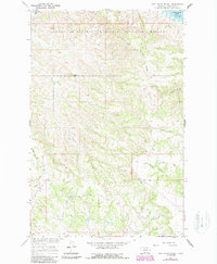
1965 Map of Pine Grove School
USGS Topo · Published 1969About this map
The Charles M Russell National Wildlife Range dominates the northern landscape of this Garfield County survey, where the rugged Missouri River breaks meet the southern reaches of the Fort Peck Reservoir. This mid-1960s mapping records a transition from the protected wilderness of the range to the ranching and agricultural lands further south. Local life is anchored at Pine Grove Sch and the small settlement of Leedy, with the community's history marked by a quiet Cem tucked away near the drainage of South Sawmill Creek. Topographic landmarks like Herman Ridge and the flat-crested Table Top provide orientation across a terrain defined by deep coulees and seasonal flows such as Devils Creek and North Sawmill Creek. The inclusion of the remote Dogtown area reflects the sparse but persistent human footprint in this corner of Montana.
Find a feature on this map
25 named features on this map. Tap any name to fly to it.
Don’t see what you’re looking for? This feature index may not catch every label — zoom into the map to look around manually.
Map Details
Editions of this 1965 Pine Grove School Map
2 editions found
Other maps of this area

1954 · Jordan
USGS Topo · 1:250,000

1956 · Jordan
USGS Topo · 1:250,000

1958 · Jordan
USGS Topo · 1:250,000

1964 · Jordan
USGS Topo · 1:250,000

1965 · Spring Creek School
USGS Topo · 1:24,000

1965 · Lost Creek
USGS Topo · 1:24,000

1965 · Herman Point
USGS Topo · 1:24,000

1965 · Cap Rock Butte
USGS Topo · 1:24,000

1965 · Schuyler Butte
USGS Topo · 1:24,000

1971 · Sawmill Creek
USGS Topo · 1:24,000