1965 Map of Schuyler Butte
USGS Topo · Published 1969About this map
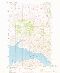
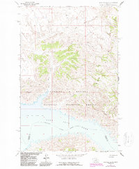
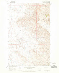
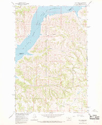
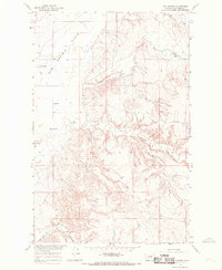
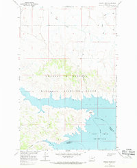
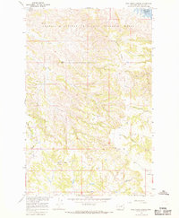
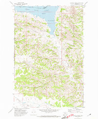
Fort Peck Reservoir dominates the southern landscape of this mid-1960s study, where the inundated Missouri River forms the boundary between Phillips and Garfield counties. The terrain is characterized by the broken breaks and coulees of the Larb Hills, rising toward the prominent Schuyler Butte and Iron Stake Ridge. Most of the land is part of the Charles M Russell National Wildlife Range, a designation reflecting the remote and undeveloped character of the Missouri River Basin development program. Evidence of local habitation is sparse, centered on small family landmarks like the Dryer Place and named drainages such as Woman Kill Creek and Johnny Creek. The map records a complex network of coulees, including La Plaz Coulee and Shed Coulee, that drain the high ridges down toward the reservoir's north shore.
Find a feature on this map
17 named features on this map. Tap any name to fly to it.
Don’t see what you’re looking for? This feature index may not catch every label — zoom into the map to look around manually.
Map Details
Editions of this 1965 Schuyler Butte Map
2 editions found
Other maps of this area

1954 · Jordan
USGS Topo · 1:250,000

1956 · Jordan
USGS Topo · 1:250,000

1958 · Jordan
USGS Topo · 1:250,000

1964 · Jordan
USGS Topo · 1:250,000
1965 · Coal Mine Hill
USGS Topo · 1:24,000
1965 · Lost Creek
USGS Topo · 1:24,000
1965 · Sun Prairie
USGS Topo · 1:24,000
1965 · Herman Point
USGS Topo · 1:24,000
1965 · Pine Grove School
USGS Topo · 1:24,000
1971 · Sawmill Creek
USGS Topo · 1:24,000