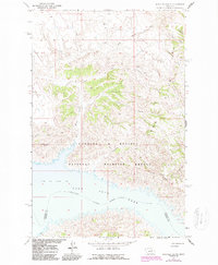
1965 Map of Schuyler Butte
USGS Topo · Published 1987About this map
Charles M Russell National Wildlife Refuge dominates the landscape in this 1960s study, where the northern breaks meet the expansive waters of Fort Peck Lake. The terrain is defined by a dense network of coulees and ridges, including the prominent Bridge Ridge and Blue Ridge, which channel drainage toward the Missouri River valley. This era shows the shoreline at a normal pool elevation of 2246 feet, revealing the intricate finger-like inlets where Kill Woman Creek and Johnny Creek meet the reservoir.
Find a feature on this map
20 named features on this map. Tap any name to fly to it.
Don’t see what you’re looking for? This feature index may not catch every label — zoom into the map to look around manually.
Map Details
Editions of this 1965 Schuyler Butte Map
2 editions found
Other maps of this area

1954 · Jordan
USGS Topo · 1:250,000

1956 · Jordan
USGS Topo · 1:250,000

1958 · Jordan
USGS Topo · 1:250,000

1964 · Jordan
USGS Topo · 1:250,000

1965 · Coal Mine Hill
USGS Topo · 1:24,000

1965 · Lost Creek
USGS Topo · 1:24,000

1965 · Sun Prairie
USGS Topo · 1:24,000

1965 · Herman Point
USGS Topo · 1:24,000

1965 · Pine Grove School
USGS Topo · 1:24,000

1965 · Schuyler Butte
USGS Topo · 1:24,000