
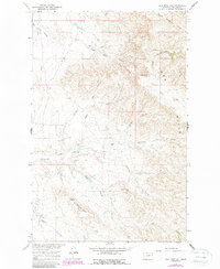
1965 Map of Coal Mine Hill
USGS Topo · Published 1969About this map
The Larb Hills define the high ground of this central Montana landscape, where the terrain breaks away into an intricate network of drainage channels. Ranching operations like the Spencer Ranch and Barnard Ranch represent the primary human imprint on this expansive rangeland during the mid-1960s. The topography is characterized by distinctive formations such as Square Butte and Barnard Buttes, rising above the surrounding coulees and creek beds.
Find a feature on this map
22 named features on this map. Tap any name to fly to it.
Don’t see what you’re looking for? This feature index may not catch every label — zoom into the map to look around manually.
Map Details
Editions of this 1965 Coal Mine Hill Map
2 editions found
Other maps of this area

1954 · Jordan
USGS Topo · 1:250,000

1956 · Jordan
USGS Topo · 1:250,000

1958 · Jordan
USGS Topo · 1:250,000

1964 · Jordan
USGS Topo · 1:250,000

1965 · Sun Prairie
USGS Topo · 1:24,000

1965 · Herman Point
USGS Topo · 1:24,000

1965 · Schuyler Butte
USGS Topo · 1:24,000

1965 · Buckley Lake
USGS Topo · 1:24,000

1965 · Sheep Coulee
USGS Topo · 1:24,000
1971 · Swede Ridge
USGS Topo · 1:24,000