
1965 Map of Sheep Coulee
USGS Topo · Published 1969About this map
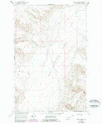
Sun Prairie Flats dominates the heart of this Phillips County landscape, representing a high, level expanse characteristic of the Missouri River Basin’s northern reaches. This 1965 survey, published just as modern land management was standardizing ranch boundaries, documents a network of intermittent drainages that define the local topography. Waterways like Sheep Coulee and The Big Flat Creek provide a blueprint of the watershed’s seasonal flow through the prairie, while Sage Creek and Box Elder Coulee mark the eastern and southern edges of the sheet. The mapping of red dashed fence lines across the terrain provides genealogists and land researchers a precise view of mid-century livestock and property divisions in this part of Montana.
Find a feature on this map
11 named features on this map. Tap any name to fly to it.
Don’t see what you’re looking for? This feature index may not catch every label — zoom into the map to look around manually.
Map Details
Editions of this 1965 Sheep Coulee Map
2 editions found
Other maps of this area

1954 · Jordan
USGS Topo · 1:250,000

1954 · Glasgow
USGS Topo · 1:250,000

1956 · Jordan
USGS Topo · 1:250,000

1957 · Glasgow
USGS Topo · 1:250,000

1958 · Glasgow
USGS Topo · 1:250,000

1958 · Jordan
USGS Topo · 1:250,000

1964 · Jordan
USGS Topo · 1:250,000

1965 · Coal Mine Hill
USGS Topo · 1:24,000

1965 · Sun Prairie
USGS Topo · 1:24,000

1965 · Whitcomb Lake
USGS Topo · 1:24,000