
1965 Map of Whitcomb Lake
USGS Topo · Published 1969About this map
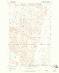
The Cotter Ranch serves as a primary marker of human settlement in this high plains landscape of Phillips County, Montana. Photographed and field checked in the mid-1960s, the terrain is defined by complex drainage systems and semi-arid topography, most notably the broad depression known as The Big Sag. This geological feature separates the northern coulees from the southern creek beds, illustrating the characteristic erosion patterns of the Missouri River Basin development area.
Find a feature on this map
9 named features on this map. Tap any name to fly to it.
Don’t see what you’re looking for? This feature index may not catch every label — zoom into the map to look around manually.
Map Details
Editions of this 1965 Whitcomb Lake Map
This is the sole edition of this map. No revisions or reprints were ever made.
Other maps of this area

1954 · Jordan
USGS Topo · 1:250,000

1954 · Glasgow
USGS Topo · 1:250,000

1956 · Jordan
USGS Topo · 1:250,000

1957 · Glasgow
USGS Topo · 1:250,000

1958 · Glasgow
USGS Topo · 1:250,000

1958 · Jordan
USGS Topo · 1:250,000

1964 · Jordan
USGS Topo · 1:250,000

1965 · Sun Prairie
USGS Topo · 1:24,000
1965 · Stratton Reservoir
USGS Topo · 1:24,000
1965 · Dione Reservoir
USGS Topo · 1:24,000