
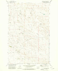
1971 Map of Wagon Coulee
USGS Topo · Published 1974About this map
Charles M Russell National Wildlife Range dominates this river-carved landscape, reflecting a 1970s view of the protected Missouri River breaks. The topography is defined by the expansive Fort Peck Lake, formed by the damming of the Missouri River, which creates a jagged, flooded shoreline through the center of the sheet. This boundary separates Valley and Garfield Counties, where the water has inundated deep ravines like Irishman Coulee and Wagon Coulee.
Find a feature on this map
18 named features on this map. Tap any name to fly to it.
Don’t see what you’re looking for? This feature index may not catch every label — zoom into the map to look around manually.
Map Details
Editions of this 1971 Wagon Coulee Map
This is the sole edition of this map. No revisions or reprints were ever made.
Other maps of this area

1954 · Jordan
USGS Topo · 1:250,000

1956 · Jordan
USGS Topo · 1:250,000

1958 · Jordan
USGS Topo · 1:250,000

1964 · Jordan
USGS Topo · 1:250,000

1971 · Hell Hollow
USGS Topo · 1:24,000

1971 · Trumbo Ranch
USGS Topo · 1:24,000

1971 · Wolfe Coulee
USGS Topo · 1:24,000

1971 · Harper Camp
USGS Topo · 1:24,000

1971 · Chalk Butte
USGS Topo · 1:24,000
1973 · Gibson Coulee
USGS Topo · 1:24,000