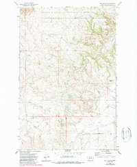
1971 Map of Hell Hollow
USGS Topo · Published 1987About this map
The Charles M Russell National Wildlife Refuge dominates the northern reaches of this map, protecting a landscape defined by deep drainages and isolated landmarks. The intricate topography of the Garfield County breaks is carved by Snow Creek and the South Fork Hell Hollow, which wind through the township and range grids of eastern Montana. These seasonal watercourses and the presence of scattered Springs and a Well reflect the arid character of the region and the critical importance of water for the area's grazing history. High points like Baldy Butte provide orientation across the complex badlands. This survey, based on 1970 data and updated in 1987, reveals the enduring isolation of the Big Dry country, where physical geography dictated the patterns of ranching and conservation.
Find a feature on this map
9 named features on this map. Tap any name to fly to it.
Don’t see what you’re looking for? This feature index may not catch every label — zoom into the map to look around manually.
Map Details
Editions of this 1971 Hell Hollow Map
2 editions found
Other maps of this area

1954 · Jordan
USGS Topo · 1:250,000

1956 · Jordan
USGS Topo · 1:250,000

1958 · Jordan
USGS Topo · 1:250,000

1964 · Jordan
USGS Topo · 1:250,000

1971 · Hell Hollow
USGS Topo · 1:24,000

1971 · Trumbo Ranch
USGS Topo · 1:24,000

1971 · Wolfe Coulee
USGS Topo · 1:24,000

1971 · Wagon Coulee
USGS Topo · 1:24,000

1971 · Harper Camp
USGS Topo · 1:24,000

1971 · Chalk Butte
USGS Topo · 1:24,000