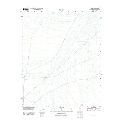
2012 Map of Joshua
USGS Topo · Published 2012About this map
Joshua sits at the convergence of several remote Mojave desert routes, where modern utility infrastructure and historic mining access intersect. The landscape is defined by its arid drainage patterns, most notably Oro Wash and the distinct topography of New Trail Canyon and Butcher Knife Canyon. This 2012 survey illustrates a critical reliance on artificial water sources in the high desert, documenting the distribution of several watering points including Sixmile Tank, Tenmile Tank, and Threemile Tank. For those tracing local industrial and transport history, the map provides detailed alignments for the Morning Star Mine Rd and its associated Morning Star Mine Cutoff, alongside the Powerline Rd. These corridors facilitate movement through the basin, connecting the small settlement of Joshua to broader regional routes like Ivanpah Cima Rd.
Find a feature on this map
14 named features on this map. Tap any name to fly to it.
Don’t see what you’re looking for? This feature index may not catch every label — zoom into the map to look around manually.
Map Details
Editions of this 2012 Joshua Map
This is the sole edition of this map. No revisions or reprints were ever made.
Other maps of this area

1910 · Ivanpah
USGS Topo · 1:250,000

1912 · Ivanpah
USGS Topo · 1:250,000

1942 · Ivanpah
USGS Topo · 1:250,000

1947 · Kingman
USGS Topo · 1:250,000

1948 · Kingman
USGS Topo · 1:250,000

1954 · Kingman
USGS Topo · 1:250,000

1955 · Kingman
USGS Topo · 1:250,000

1955 · Mescal Range
USGS Topo · 1:62,500

1955 · Mid Hills
USGS Topo · 1:62,500

1955 · Kelso
USGS Topo · 1:62,500