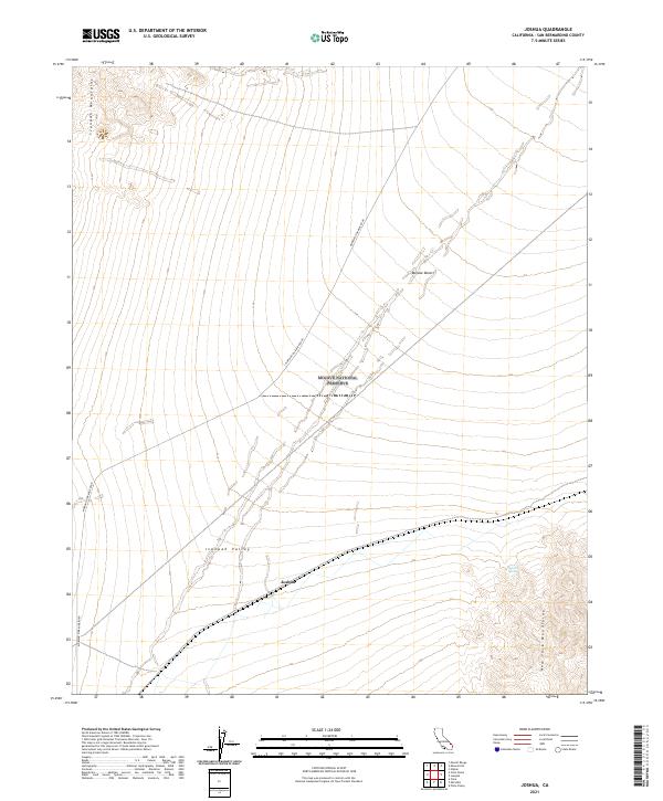
2021 Map of Joshua
USGS Topo · Published 2021About this map
Ivanpah Valley forms the central basin of this high desert terrain, framed by the stark elevations of the Ivanpah Mountains to the northwest and the New York Mountains in the southeast. This 2021 survey of the Mojave National Preserve documents the sparse infrastructure of the region, anchored by the tiny settlement of Joshua and the transit corridor of Morning Star Mine Road. The landscape is characterized by its isolation, with Sacaton Spring providing one of the few named water sources in an environment defined by the open expanses of the Mojave Desert. The map reveals the intricate network of section lines and township boundaries, including t15n r14e and t14n r15e, which overlay a landscape where industrial history and conservation efforts meet.
Find a feature on this map
12 named features on this map. Tap any name to fly to it.
Don’t see what you’re looking for? This feature index may not catch every label — zoom into the map to look around manually.
Map Details
Editions of this 2021 Joshua Map
This is the sole edition of this map. No revisions or reprints were ever made.
Other maps of this area

1910 · Ivanpah
USGS Topo · 1:250,000

1912 · Ivanpah
USGS Topo · 1:250,000

1942 · Ivanpah
USGS Topo · 1:250,000

1947 · Kingman
USGS Topo · 1:250,000

1948 · Kingman
USGS Topo · 1:250,000

1954 · Kingman
USGS Topo · 1:250,000

1955 · Kingman
USGS Topo · 1:250,000

1955 · Mescal Range
USGS Topo · 1:62,500

1955 · Mid Hills
USGS Topo · 1:62,500

1955 · Kelso
USGS Topo · 1:62,500