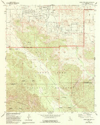
1972 Map of Joshua Tree South
USGS Topo · Published 1994About this map
Joshua Tree sits at the northern edge of this high-desert landscape, where the residential grid of Alta Loma Drive and Latham Road meets the expanse of the Joshua Tree National Monument and Wilderness Boundary. The terrain shifts from the developed foothills into the transition between Lower Covington Flat and Upper Covington Flat, a region defined by seasonal drainage and scattered water sources. Vital desert landmarks such as Coyote Hole Spring and the Gaging Station indicate the precarious management of water in this arid environment.
Find a feature on this map
31 named features on this map. Tap any name to fly to it.
Don’t see what you’re looking for? This feature index may not catch every label — zoom into the map to look around manually.
Map Details
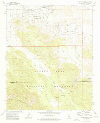
Editions of this 1972 Joshua Tree South Map
2 editions found
Other maps of this area

1941 · Edom
USGS Topo · 1:62,500

1944 · Edom
USGS Topo · 1:62,500

1944 · Pinyon Well
USGS Topo · 1:62,500

1947 · Santa Ana
USGS Topo · 1:250,000

1949 · Santa Ana
USGS Topo · 1:250,000

1953 · San Bernardino
USGS Topo · 1:250,000

1955 · Twentynine Palms
USGS Topo · 1:62,500

1955 · Joshua Tree
USGS Topo · 1:62,500

1956 · San Bernardino
USGS Topo · 1:250,000

1956 · Santa Ana
USGS Topo · 1:250,000