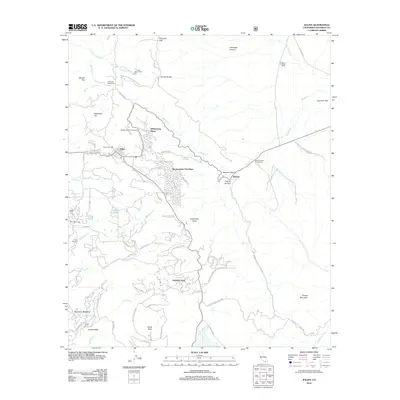
2012 Map of Julian
USGS Topo · Published 2012About this map
Julian remains the central anchor of this San Diego County highlands landscape, shown here in 2012. The town's historic character is reflected in its established layout, including the Julian Cem and the local Po. Moving east, the terrain drops dramatically into Banner Canyon and the settlement of Banner, where the Banner Queen Trading Post stands as a landmark of the mountain passage. The map details a transition from the dense residential clusters of Kentwood-In-The-Pines and Whispering Pines to the more open, high-altitude flats like Ferguson Flat and Kanaka Flat.
Find a feature on this map
78 named features on this map. Tap any name to fly to it.
Don’t see what you’re looking for? This feature index may not catch every label — zoom into the map to look around manually.
Map Details
Editions of this 2012 Julian Map
This is the sole edition of this map. No revisions or reprints were ever made.
Other maps of this area

1903 · Cuyamaca
USGS Topo · 1:125,000

1903 · Ramona
USGS Topo · 1:125,000

1904 · Southern California Sheet No. 2
USGS Topo · 1:250,000

1931 · Vallecito
USGS Topo · 1:125,000

1931 · Carrizo
USGS Topo · 1:125,000

1939 · Santa Ysabel
USGS Topo · 1:62,500

1939 · Borrego
USGS Topo · 1:62,500

1942 · Borego
USGS Topo · 1:62,500

1942 · Cuyapaipe
USGS Topo · 1:62,500

1942 · Cuyamaca Peak
USGS Topo · 1:62,500