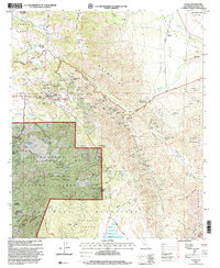
1997 Map of Julian
USGS Topo · Published 2000About this map
The gold-mining legacy of the late 19th-century boom is etched across the mountains surrounding Julian. This 1997 revision shows a landscape where industrial history meets forest conservation, notably within the Cleveland National Forest and William Heise County Park. The concentration of mining claims in Banner Canyon and the high ridges—including the Eagle Mine, High Peak Mine, and Ready Relief Mine—illustrates the intensive extraction that once drove the local economy.
Find a feature on this map
86 named features on this map. Tap any name to fly to it.
Don’t see what you’re looking for? This feature index may not catch every label — zoom into the map to look around manually.
Map Details
Editions of this 1997 Julian Map
This is the sole edition of this map. No revisions or reprints were ever made.
Other maps of this area

1903 · Cuyamaca
USGS Topo · 1:125,000

1903 · Ramona
USGS Topo · 1:125,000

1904 · Southern California Sheet No. 2
USGS Topo · 1:250,000

1931 · Vallecito
USGS Topo · 1:125,000

1931 · Carrizo
USGS Topo · 1:125,000

1939 · Santa Ysabel
USGS Topo · 1:62,500

1939 · Borrego
USGS Topo · 1:62,500

1942 · Borego
USGS Topo · 1:62,500

1942 · Cuyapaipe
USGS Topo · 1:62,500

1942 · Cuyamaca Peak
USGS Topo · 1:62,500