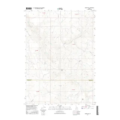
2017 Map of Jumpoff Hill
USGS Topo · Published 2017About this map
Jumpoff Hill rises as a central landmark in this high-country landscape along the border of Bonneville and Bingham counties. The area is defined by a complex drainage network where Grays Lake Outlet flows past Outlet Ridge, joined by numerous seasonal and year-round streams such as Bailey Cr and Hell Cr. The presence of Empey Spring and the deeply cut Sawmill Canyon suggests a history of water management and timber resource use in this corner of Idaho.
Find a feature on this map
25 named features on this map. Tap any name to fly to it.
Don’t see what you’re looking for? This feature index may not catch every label — zoom into the map to look around manually.
Map Details
Editions of this 2017 Jumpoff Hill Map
This is the sole edition of this map. No revisions or reprints were ever made.
Other maps of this area

1917 · Cranes Flat
USGS Topo · 1:62,500

1918 · Paradise Valley
USGS Topo · 1:62,500

1924 · Hell Creek
USGS Topo · 1:62,500

1924 · Ammon
USGS Topo · 1:62,500

1926 · Hell Creek
USGS Topo · 1:62,500

1955 · Driggs
USGS Topo · 1:250,000

1958 · Driggs
USGS Topo · 1:250,000

1962 · Driggs
USGS Topo · 1:250,000
1963 · Bone
USGS Topo · 1:24,000
1981 · Point Lookout
USGS Topo · 1:24,000