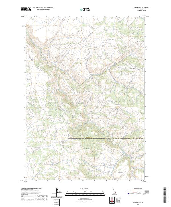
2024 Map of Jumpoff Hill
USGS Topo · Published 2024About this map
Caribou Range topography dominates this 2024 U.S. Geological Survey topographic map, where the border between Bonneville and Bingham Counties cuts through a landscape defined by ridges and deep drainage canyons. Central to the sheet is the prominence of Jumpoff Hill, overlooking the winding Bailey Creek and the headwaters of several drainages. The complex hydrography of the region is evident in the path of the Grays Lake Outlet, which snakes through the central valley toward Sawmill Canyon.
Find a feature on this map
26 named features on this map. Tap any name to fly to it.
Don’t see what you’re looking for? This feature index may not catch every label — zoom into the map to look around manually.
Map Details
Editions of this 2024 Jumpoff Hill Map
This is the sole edition of this map. No revisions or reprints were ever made.
Other maps of this area

1917 · Cranes Flat
USGS Topo · 1:62,500

1918 · Paradise Valley
USGS Topo · 1:62,500

1924 · Hell Creek
USGS Topo · 1:62,500

1924 · Ammon
USGS Topo · 1:62,500

1926 · Hell Creek
USGS Topo · 1:62,500

1955 · Driggs
USGS Topo · 1:250,000

1958 · Driggs
USGS Topo · 1:250,000

1962 · Driggs
USGS Topo · 1:250,000
1963 · Bone
USGS Topo · 1:24,000
1981 · Point Lookout
USGS Topo · 1:24,000