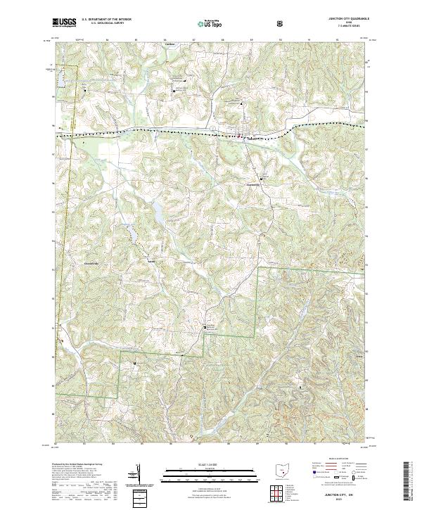
2023 Map of Junction City
USGS Topo · Published 2023About this map
Junction City serves as the primary hub of this landscape, where the waters of Rush Creek and its various tributaries define the valley floor. The map documents a dense network of local township and county roads that connect outlying settlements like Clarksville, Crossenville, and Salem. This area is particularly notable for its concentration of spiritual and commemorative sites, including the Mount Zion United Brethren in Christ Ch and numerous family or denominational burial grounds such as Old Zion United Brethren Cem and Saint Patricks Cem. To the south, the terrain transitions into the protected boundaries of the Wayne National Forest. Here, the landscape becomes more dissected by drainage features like Coalbrook Hollow and Lime Kiln Hollow, while the North Country National Scenic Trl provides a transit route for those navigating the wooded ridges and creek bottoms.
Find a feature on this map
97 named features on this map. Tap any name to fly to it.
Don’t see what you’re looking for? This feature index may not catch every label — zoom into the map to look around manually.
Map Details
Editions of this 2023 Junction City Map
This is the sole edition of this map. No revisions or reprints were ever made.
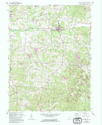
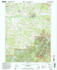
Historical Maps of Junction City Through Time
3 maps found