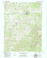
1961 Map of Junction City
USGS Topo · Published 1994About this map
Junction City serves as the industrial and social hub of this western Perry County landscape, where the local economy transitions from the Kilns and rail infrastructure of the town to the extensive extraction efforts marked by Strip Mines to the northeast. The topography is defined by the winding course of Rush Creek and its southern tributaries, including Dry Run and Turkey Run. This area preserves a dense network of nineteenth-century social centers, evidenced by numerous rural congregations such as Mt Zion Ch and Bethel Ch.
Find a feature on this map
43 named features on this map. Tap any name to fly to it.
Don’t see what you’re looking for? This feature index may not catch every label — zoom into the map to look around manually.
Map Details
Editions of this 1961 Junction City Map
Other maps of this area

1907 · Logan
USGS Topo · 1:62,500

1909 · Thornville
USGS Topo · 1:62,500

1909 · Logan
USGS Topo · 1:62,500

1910 · Zanesville
USGS Topo · 1:62,500

1911 · New Lexington
USGS Topo · 1:62,500

1947 · Columbus
USGS Topo · 1:250,000

1961 · Columbus
USGS Topo · 1:250,000

1961 · Rushville
USGS Topo · 1:24,000

1961 · New Lexington
USGS Topo · 1:24,000
1961 · New Straitsville
USGS Topo · 1:24,000