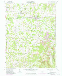
1961 Map of Junction City
USGS Topo · Published 1977About this map
Junction City serves as the industrial and rail hub of this Perry County landscape, situated at the crossing of the Baltimore and Ohio and Conrail lines. The town's economic character is defined by its proximity to mineral extraction and processing, evidenced by the clustered kilns and numerous strip mines dotting the surrounding hills. North of the center, the Ohio State Penitentiary Junction City Branch occupies a significant tract near the Sewage Disposal plant.
Find a feature on this map
43 named features on this map. Tap any name to fly to it.
Don’t see what you’re looking for? This feature index may not catch every label — zoom into the map to look around manually.
Map Details
Editions of this 1961 Junction City Map
Other maps of this area

1907 · Logan
USGS Topo · 1:62,500

1909 · Thornville
USGS Topo · 1:62,500

1909 · Logan
USGS Topo · 1:62,500

1910 · Zanesville
USGS Topo · 1:62,500

1911 · New Lexington
USGS Topo · 1:62,500

1947 · Columbus
USGS Topo · 1:250,000

1961 · Columbus
USGS Topo · 1:250,000

1961 · Rushville
USGS Topo · 1:24,000

1961 · New Lexington
USGS Topo · 1:24,000
1961 · New Straitsville
USGS Topo · 1:24,000