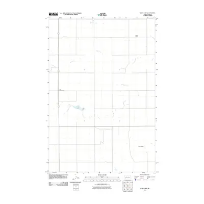
2011 Map of Jung Lake
USGS Topo · Published 2011About this map
Coal Bank Creek and Goose Creek wind through this rural Hettinger County landscape, defining a region where water management and cemetery preservation are the primary landmarks of human presence. The centerpiece of the map, Jung Lake, is held by the Jung Dam, illustrating the local reliance on man-made reservoirs for agricultural or conservation purposes. The presence of Rainy Butte Cemetery and Havelock Cemetery provides essential locations for genealogists researching the early 21st-century state of local burial grounds. To the southeast, the Tepee Buttes rise as a distinctive landform, breaking the prairie horizon. This 2011 survey by the U.S. Geological Survey documents a quiet corner of North Dakota along Havelock Rd, capturing the intersection of natural drainage systems like Coon Creek with established property lines and rural infrastructure.
Find a feature on this map
9 named features on this map. Tap any name to fly to it.
Don’t see what you’re looking for? This feature index may not catch every label — zoom into the map to look around manually.
Map Details
Editions of this 2011 Jung Lake Map
This is the sole edition of this map. No revisions or reprints were ever made.
Other maps of this area

1953 · Dickinson
USGS Topo · 1:250,000

1957 · Dickinson
USGS Topo · 1:250,000

1973 · Liens Dams
USGS Topo · 1:24,000

1973 · Cedar Lake
USGS Topo · 1:24,000

1973 · Jung Lake
USGS Topo · 1:24,000

1973 · New England
USGS Topo · 1:24,000

1973 · Lefor SW
USGS Topo · 1:24,000

1973 · Havelock
USGS Topo · 1:24,000

1973 · East Rainy Butte
USGS Topo · 1:24,000

1973 · Enterprise School
USGS Topo · 1:24,000