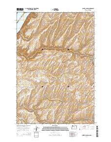
2014 Map of Juniper Canyon
USGS Topo · Published 2014About this map
The Columbia River and Lake Wallula define the northwestern corner of this territory, where the state boundary between Washington and Oregon meets the line separating Benton and Umatilla counties. This landscape is characterized by a complex network of drainages cutting through the high plateau, including the expansive Juniper Canyon system and its north and south forks. Farther south, McCall Canyon and North Fork Cold Springs Canyon carve into the terrain, reflecting the arid geography of the region. Local transportation is facilitated by rural routes such as Wallula Rd and Hartle Rd, while the presence of Badger Springs suggests a critical water source in an otherwise dry environment. The mapping reveals a sparse settlement pattern dominated by the natural topography of these intersecting canyon systems and the broad waterway of the Columbia.
Find a feature on this map
24 named features on this map. Tap any name to fly to it.
Don’t see what you’re looking for? This feature index may not catch every label — zoom into the map to look around manually.
Map Details
Editions of this 2014 Juniper Canyon Map
This is the sole edition of this map. No revisions or reprints were ever made.
Other maps of this area

1908 · Umatilla
USGS Topo · 1:125,000

1915 · Wallulah
USGS Topo · 1:96,000

1917 · Pasco
USGS Topo · 1:125,000

1918 · Wallula
USGS Topo · 1:125,000

1935 · Pendleton
USGS Topo · 1:125,000

1953 · Pendleton
USGS Topo · 1:250,000

1953 · Walla Walla
USGS Topo · 1:250,000

1956 · Pendleton
USGS Topo · 1:250,000

1958 · Walla Walla
USGS Topo · 1:250,000

1962 · Juniper
USGS Topo · 1:24,000