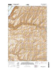
2017 Map of Juniper Canyon
USGS Topo · Published 2017About this map
Lake Wallula defines the northwestern corner of this landscape, marking the reach of the Columbia River where the Washington and Oregon borders meet. The terrain is deeply incised by a series of drainages, most notably the winding course of Juniper Canyon and its tributaries, the North Fork Juniper Canyon and South Fork Juniper Canyon. Further south, the map details the passage of North Fork Cold Springs Canyon and the smaller McCall Canyon, reflecting a topography shaped by seasonal water flow in this arid border region. Transport through these corridors is facilitated by long-established routes such as Wallula Rd and Hartle Rd, which follow the natural contours of the high desert plateau. A few specific landmarks, like Badger Springs, point to the location of vital water sources in an otherwise dry and sparsely developed environment.
Find a feature on this map
16 named features on this map. Tap any name to fly to it.
Don’t see what you’re looking for? This feature index may not catch every label — zoom into the map to look around manually.
Map Details
Editions of this 2017 Juniper Canyon Map
This is the sole edition of this map. No revisions or reprints were ever made.
Other maps of this area

1908 · Umatilla
USGS Topo · 1:125,000

1915 · Wallulah
USGS Topo · 1:96,000

1917 · Pasco
USGS Topo · 1:125,000

1918 · Wallula
USGS Topo · 1:125,000

1935 · Pendleton
USGS Topo · 1:125,000

1953 · Pendleton
USGS Topo · 1:250,000

1953 · Walla Walla
USGS Topo · 1:250,000

1956 · Pendleton
USGS Topo · 1:250,000

1958 · Walla Walla
USGS Topo · 1:250,000

1962 · Juniper
USGS Topo · 1:24,000