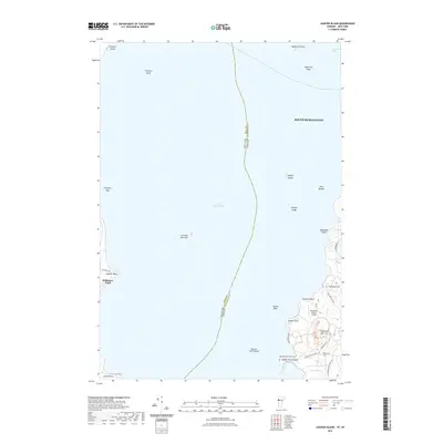
2021 Map of Juniper Island
USGS Topo · Published 2021About this map
Lake Champlain serves as the central landscape of this 2021 survey, marking the state boundary between Vermont and New York. The map details the waters off South Burlington, where numerous hazards and islands dot the lake, including Schuyler Island, Juniper Island, and the distinctive cluster of The Four Brothers. Along the Vermont shoreline, the topography rises toward Lone Tree Hill and Pheasant Hill, revealing a mix of agricultural land and established estates. Genealogists and local historians will find significant detail near Quaker Smith Point, where both the Quaker Smith Point Cem and Webb Cem are located. The presence of the Shelburne Farms Airport and a network of rural roads like Quakers Smith Point Rd and Harbor Rd illustrates the area's continued use as a coastal hub for travel and community life.
Find a feature on this map
37 named features on this map. Tap any name to fly to it.
Don’t see what you’re looking for? This feature index may not catch every label — zoom into the map to look around manually.
Map Details
Editions of this 2021 Juniper Island Map
This is the sole edition of this map. No revisions or reprints were ever made.
Other maps of this area

1894 · Plattsburg
USGS Topo · 1:62,500

1895 · Willsboro
USGS Topo · 1:62,500

1906 · Plattsburg
USGS Topo · 1:62,500

1906 · Burlington
USGS Topo · 1:62,500

1913 · Milton
USGS Topo · 1:48,000

1915 · Milton
USGS Topo · 1:62,500

1919 · Burlington
USGS Topo · 1:62,500

1939 · Plattsburg
USGS Topo · 1:62,500

1941 · Plattsburg
USGS Topo · 1:62,500

1941 · Willsboro
USGS Topo · 1:62,500