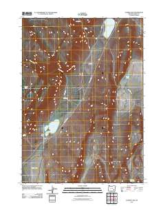
2011 Map of Juniper Lake
USGS Topo · Published 2011About this map
Juniper Lake and its surrounding high-desert basins anchor this remote stretch of Harney County, Oregon. The landscape is defined by intermittent water sources and the large, shallow depressions of Ten-Cent Lake, Fifteen Cent Lake, and Heath Lake. These ephemeral features, alongside drainage systems like Squaw Creek and Heath Creek, suggest a terrain shaped by seasonal moisture and volcanic geography. Human activity is sparse but notable, centered on established operations such as the Juniper Lake Ranch and Anderson Ranch.
Find a feature on this map
19 named features on this map. Tap any name to fly to it.
Don’t see what you’re looking for? This feature index may not catch every label — zoom into the map to look around manually.
Map Details
Editions of this 2011 Juniper Lake Map
This is the sole edition of this map. No revisions or reprints were ever made.
Other maps of this area

1955 · Burns
USGS Topo · 1:250,000

1955 · Adel
USGS Topo · 1:250,000

1957 · Adel
USGS Topo · 1:250,000

1958 · Burns
USGS Topo · 1:250,000

1958 · Adel
USGS Topo · 1:250,000

1959 · Burns
USGS Topo · 1:250,000

1962 · Adel
USGS Topo · 1:250,000

1974 · Anderson Mtn
USGS Topo · 1:62,500
1974 · Folly Farm
USGS Topo · 1:24,000
1974 · Folly Farm
USGS Topo · 1:62,500