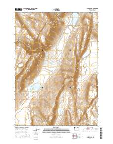
2014 Map of Juniper Lake
USGS Topo · Published 2014About this map
Steens Mtn dominates this high-desert landscape in southeastern Oregon, where the eastern slopes descend toward the Alvord Valley. This 2014 survey documents a complex system of ephemeral water bodies and springs that define the local hydrology. Notable features include the eponymous Juniper Lake, as well as Fifteen Cent Lake, Squaw Lake, Heath Lake, and South Lake. These basins, along with Pollock Reservoir, suggest the importance of seasonal water management in this arid region.
Find a feature on this map
17 named features on this map. Tap any name to fly to it.
Don’t see what you’re looking for? This feature index may not catch every label — zoom into the map to look around manually.
Map Details
Editions of this 2014 Juniper Lake Map
This is the sole edition of this map. No revisions or reprints were ever made.
Other maps of this area

1955 · Burns
USGS Topo · 1:250,000

1955 · Adel
USGS Topo · 1:250,000

1957 · Adel
USGS Topo · 1:250,000

1958 · Burns
USGS Topo · 1:250,000

1958 · Adel
USGS Topo · 1:250,000

1959 · Burns
USGS Topo · 1:250,000

1962 · Adel
USGS Topo · 1:250,000

1974 · Anderson Mtn
USGS Topo · 1:62,500
1974 · Folly Farm
USGS Topo · 1:24,000
1974 · Folly Farm
USGS Topo · 1:62,500