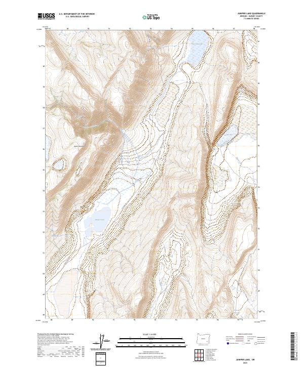
2023 Map of Juniper Lake
USGS Topo · Published 2023About this map
Steens Mountain dominates the western landscape of this Harney County quadrangle, where the steep terrain gives way to a high-desert basin defined by seasonal water and alkali flats. The topographic detail follows the descent from the mountain peaks down the Juniper Grade, a route that connects the heights to the drainage systems below. Surface water is precious in this environment, represented by the presence of Ten Cent Lake in the north and the expansive Juniper Lake to the southwest. Smaller catchments like Heath Lake and Pollock Reservoir suggest the importance of water management in a region where creeks like Heath Creek and Ede-hu-de Creek are central to the geography. Isolated water sources such as Neal Spring and Negro Spring serve as vital landmarks for those navigating the high-desert floor between the mountain and the flats.
Find a feature on this map
17 named features on this map. Tap any name to fly to it.
Don’t see what you’re looking for? This feature index may not catch every label — zoom into the map to look around manually.
Map Details
Editions of this 2023 Juniper Lake Map
This is the sole edition of this map. No revisions or reprints were ever made.
Other maps of this area

1955 · Burns
USGS Topo · 1:250,000

1955 · Adel
USGS Topo · 1:250,000

1957 · Adel
USGS Topo · 1:250,000

1958 · Burns
USGS Topo · 1:250,000

1958 · Adel
USGS Topo · 1:250,000

1959 · Burns
USGS Topo · 1:250,000

1962 · Adel
USGS Topo · 1:250,000

1974 · Anderson Mtn
USGS Topo · 1:62,500
1974 · Folly Farm
USGS Topo · 1:24,000
1974 · Folly Farm
USGS Topo · 1:62,500