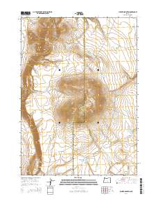
2014 Map of Juniper Mountain
USGS Topo · Published 2014About this map
Juniper Mountain and Grays Butte dominate this high-desert terrain along the boundary of Lake and Harney counties. This 2014 survey documents a landscape of essential water management and livestock infrastructure in the Oregon outback. Local stockmen and land managers will recognize key features such as the Browns Horse Corral Waterhole and the Radio Springs Reservoir. Transportation through this arid region is anchored by the Lakeview-Burns Hwy, while a network of primitive routes including Bacon Camp Rd, Big Juniper Rd, and Little Juniper Rd provide access to the interior. The map also traces the drainage patterns of Badger Draw and the Badger Draw Reservoir, illustrating the critical role of moisture collection in the Great Basin's rimrock country.
Find a feature on this map
17 named features on this map. Tap any name to fly to it.
Don’t see what you’re looking for? This feature index may not catch every label — zoom into the map to look around manually.
Map Details
Editions of this 2014 Juniper Mountain Map
This is the sole edition of this map. No revisions or reprints were ever made.
Other maps of this area

1955 · Crescent
USGS Topo · 1:250,000

1955 · Klamath Falls
USGS Topo · 1:250,000

1955 · Burns
USGS Topo · 1:250,000

1955 · Adel
USGS Topo · 1:250,000

1957 · Adel
USGS Topo · 1:250,000

1957 · Crescent
USGS Topo · 1:250,000

1958 · Crescent
USGS Topo · 1:250,000

1958 · Klamath Falls
USGS Topo · 1:250,000

1958 · Burns
USGS Topo · 1:250,000

1958 · Adel
USGS Topo · 1:250,000