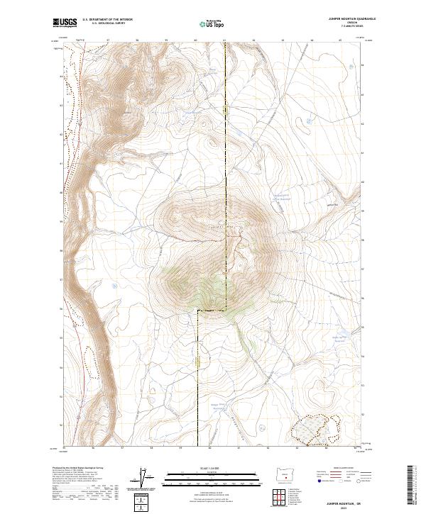
2023 Map of Juniper Mountain
USGS Topo · Published 2023About this map
Juniper Mtn dominates this high-desert landscape on the boundary of Lake and Harney Counties, an area defined by isolated water sources and expansive relief. This 2023 survey by the U.S. Geological Survey illustrates a landscape organized around vital water management for ranching and wildlife, featuring the Sheep Reservoir, Grays Reservoir, and the uniquely named Browns Horse Corral Waterhole. The terrain transitions from the floor of Alkali Valley up to prominent landmarks like Grays Butte and the long stretch of Rehart Rim. A network of backcountry routes, including Bacon Camp Rd and several Forest Development roads, provides access to this remote corner of Oregon. The mapping of Radio Springs Reservoir and Badger Draw Reservoir alongside various draws and canyons reflects the critical importance of topography in directing seasonal runoff across this arid high-elevation plateau.
Find a feature on this map
25 named features on this map. Tap any name to fly to it.
Don’t see what you’re looking for? This feature index may not catch every label — zoom into the map to look around manually.
Map Details
Editions of this 2023 Juniper Mountain Map
This is the sole edition of this map. No revisions or reprints were ever made.
Other maps of this area

1955 · Crescent
USGS Topo · 1:250,000

1955 · Klamath Falls
USGS Topo · 1:250,000

1955 · Burns
USGS Topo · 1:250,000

1955 · Adel
USGS Topo · 1:250,000

1957 · Adel
USGS Topo · 1:250,000

1957 · Crescent
USGS Topo · 1:250,000

1958 · Crescent
USGS Topo · 1:250,000

1958 · Klamath Falls
USGS Topo · 1:250,000

1958 · Burns
USGS Topo · 1:250,000

1958 · Adel
USGS Topo · 1:250,000