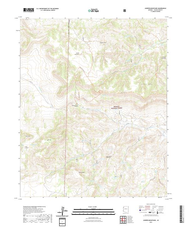
2021 Map of Juniper Mountains
USGS Topo · Published 2021About this map
Prescott National Forest covers a significant portion of this landscape, defining a network of high-elevation peaks and canyon systems. The namesake Juniper Mountains dominate the northern terrain, where prominent landmarks like Gobbler Knob and the flat-topped Juniper Mesa rise above the surrounding drainages. This high-desert environment relies on scattered water sources, documented here through numerous tanks and springs such as Thirtythree Tank and Government Spring.
Find a feature on this map
57 named features on this map. Tap any name to fly to it.
Don’t see what you’re looking for? This feature index may not catch every label — zoom into the map to look around manually.
Map Details
Editions of this 2021 Juniper Mountains Map
This is the sole edition of this map. No revisions or reprints were ever made.
Other maps of this area

1886 · Diamond Creek
USGS Topo · 1:250,000

1886 · Chino
USGS Topo · 1:250,000

1887 · Prescott
USGS Topo · 1:250,000

1891 · Chino
USGS Topo · 1:250,000

1892 · Diamond Creek
USGS Topo · 1:250,000

1892 · Prescott
USGS Topo · 1:250,000

1923 · Signal
USGS Topo · 1:250,000

1942 · Signal
USGS Topo · 1:250,000

1947 · Turkey Canyon
USGS Topo · 1:62,500

1947 · Camp Wood
USGS Topo · 1:62,500