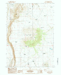
1984 Map of Juniper Mtn
USGS Topo · Published 1984About this map
Juniper Mountain and the imposing Abert Rim dominate this high desert landscape along the border of Lake and Harney counties. This 1980s survey captures a region defined by its water management and livestock history, where seasonal hydrology is marked by numerous waterholes and springs. The map documents the infrastructure of remote ranching life, from the Leehmann Cow Camp in the north to the Clark Cow Camp and Browns Horse Corral Waterhole further south. The Alkali Valley floor to the west contrasts sharply with the elevated terrain of Grays Butte and the plateau. Notable features like the Highway Maintenance Station along Route 395 and various reservoirs, such as Radio Reservoir and Badger Draw Reservoir, illustrate the human effort to sustain activity in this arid environment.
Find a feature on this map
34 named features on this map. Tap any name to fly to it.
Don’t see what you’re looking for? This feature index may not catch every label — zoom into the map to look around manually.
Map Details
Editions of this 1984 Juniper Mtn Map
This is the sole edition of this map. No revisions or reprints were ever made.
Other maps of this area

1955 · Crescent
USGS Topo · 1:250,000

1955 · Klamath Falls
USGS Topo · 1:250,000

1955 · Burns
USGS Topo · 1:250,000

1955 · Adel
USGS Topo · 1:250,000

1957 · Adel
USGS Topo · 1:250,000

1957 · Crescent
USGS Topo · 1:250,000

1958 · Crescent
USGS Topo · 1:250,000

1958 · Klamath Falls
USGS Topo · 1:250,000

1958 · Burns
USGS Topo · 1:250,000

1958 · Adel
USGS Topo · 1:250,000