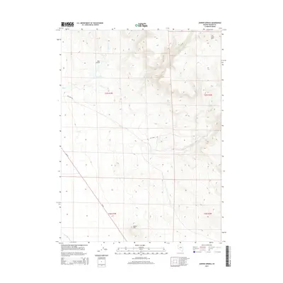
2015 Map of Juniper Springs
USGS Topo · Published 2015About this map
Wall Canyon and its namesake Wall Cr define the high desert landscape of this portion of Washoe County. The hydrology of the region is centered around the Lower Wall Canyon Reservoir, a significant water feature in an otherwise arid terrain characterized by intermittent flows like Duck Flat Wash and Cherry Cr. The elevation varies from the prominent Round Mtn to the undulating Lost Creek Hills, where seasonal water sources such as Cherry Springs and Juniper Springs provided vital points of interest for early land use and surveying. Infrastructure is sparse, primarily represented by Lost Creek Rd and CR 447, which provide the main access through these expansive public and private land blocks during the early twenty-first century.
Find a feature on this map
16 named features on this map. Tap any name to fly to it.
Don’t see what you’re looking for? This feature index may not catch every label — zoom into the map to look around manually.
Map Details
Editions of this 2015 Juniper Springs Map
This is the sole edition of this map. No revisions or reprints were ever made.
Other maps of this area

1886 · Granite Range
USGS Topo · 1:250,000

1889 · Long Valley
USGS Topo · 1:250,000

1894 · Granite Range
USGS Topo · 1:250,000

1954 · Vya
USGS Topo · 1:250,000

1955 · Lovelock
USGS Topo · 1:250,000

1958 · Vya
USGS Topo · 1:250,000

1959 · Lovelock
USGS Topo · 1:250,000

1962 · Vya
USGS Topo · 1:250,000
1979 · Wall Canyon Reservoir
USGS Topo · 1:24,000
1979 · Duck Lake
USGS Topo · 1:24,000