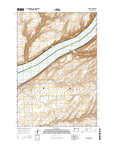
2014 Map of Juniper
USGS Topo · Published 2014About this map
Lake Wallula and the Columbia River dominate this 2014 survey, marking the interstate boundary between Benton County, Washington, and Umatilla County, Oregon. The small settlement of Juniper sits on the eastern bank of the river, positioned at the mouth of Juniper Canyon where the waterway carves into the Columbia Plateau. The landscape is characterized by deeply incised drainages, including Spaw Canyon and Switzler Canyon, which reach toward the shoreline.
Find a feature on this map
22 named features on this map. Tap any name to fly to it.
Don’t see what you’re looking for? This feature index may not catch every label — zoom into the map to look around manually.
Map Details
Editions of this 2014 Juniper Map
This is the sole edition of this map. No revisions or reprints were ever made.
Other maps of this area

1908 · Umatilla
USGS Topo · 1:125,000

1915 · Wallulah
USGS Topo · 1:96,000

1917 · Pasco
USGS Topo · 1:125,000

1918 · Wallula
USGS Topo · 1:125,000

1935 · Pendleton
USGS Topo · 1:125,000

1953 · Pendleton
USGS Topo · 1:250,000

1953 · Walla Walla
USGS Topo · 1:250,000

1956 · Pendleton
USGS Topo · 1:250,000

1958 · Walla Walla
USGS Topo · 1:250,000

1962 · Hat Rock
USGS Topo · 1:24,000