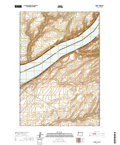
2020 Map of Juniper
USGS Topo · Published 2020About this map
The Columbia River serves as the central artery of this landscape, marking the interstate border between Washington and Oregon. Much of the river’s width here is occupied by Lake Wallula, the reservoir created by downstream damming, which surrounds Van Skinner Island and creates a broad, watery divide between the Columbia Plateau in Washington and the dry canyonlands of Oregon. This survey captures a terrain defined by deep erosional cuts, where the high benchlands are punctuated by dramatic features such as Juniper Canyon and Spaw Canyon.
Find a feature on this map
18 named features on this map. Tap any name to fly to it.
Don’t see what you’re looking for? This feature index may not catch every label — zoom into the map to look around manually.
Map Details
Editions of this 2020 Juniper Map
This is the sole edition of this map. No revisions or reprints were ever made.
Other maps of this area

1908 · Umatilla
USGS Topo · 1:125,000

1915 · Wallulah
USGS Topo · 1:96,000

1917 · Pasco
USGS Topo · 1:125,000

1918 · Wallula
USGS Topo · 1:125,000

1935 · Pendleton
USGS Topo · 1:125,000

1953 · Pendleton
USGS Topo · 1:250,000

1953 · Walla Walla
USGS Topo · 1:250,000

1956 · Pendleton
USGS Topo · 1:250,000

1958 · Walla Walla
USGS Topo · 1:250,000

1962 · Hat Rock
USGS Topo · 1:24,000