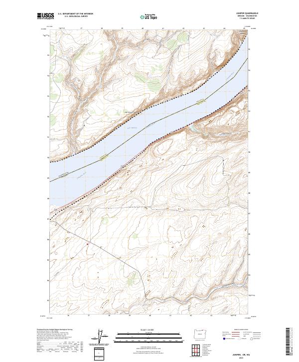
2023 Map of Juniper
USGS Topo · Published 2023About this map
McNary National Wildlife Refuge dominates the riparian corridor along the Columbia River in this modern survey of the Oregon-Washington border. This area, where the river widens into Lake Wallula, is defined by the sharp contrast between the protected wetlands and the rising basalt edges of the Columbia Plateau. The map documents a rugged landscape carved by several prominent drainages, including Switzler Canyon and Juniper Canyon, which cut through the high desert terrain toward the water. Human presence is marked by rural connectors such as Kosmos Rd and Wallula Rd, which navigate the complex topography of the river bluffs. Small features like Van Skinner Island provide specific points of reference for those studying the evolving shoreline and habitat management in Umatilla and Benton counties.
Find a feature on this map
18 named features on this map. Tap any name to fly to it.
Don’t see what you’re looking for? This feature index may not catch every label — zoom into the map to look around manually.
Map Details
Editions of this 2023 Juniper Map
This is the sole edition of this map. No revisions or reprints were ever made.
Other maps of this area

1908 · Umatilla
USGS Topo · 1:125,000

1915 · Wallulah
USGS Topo · 1:96,000

1917 · Pasco
USGS Topo · 1:125,000

1918 · Wallula
USGS Topo · 1:125,000

1935 · Pendleton
USGS Topo · 1:125,000

1953 · Pendleton
USGS Topo · 1:250,000

1953 · Walla Walla
USGS Topo · 1:250,000

1956 · Pendleton
USGS Topo · 1:250,000

1958 · Walla Walla
USGS Topo · 1:250,000

1962 · Hat Rock
USGS Topo · 1:24,000