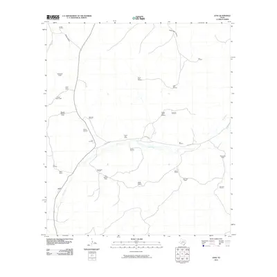
2010 Map of Juno
USGS Topo · Published 2010About this map
The settlement of Juno serves as the focal point for this section of Val Verde County, where the arid landscape is defined by its dependency on scattered water sources. The Devils River cuts through the territory, joined by a complex network of seasonal drainages including Cully Draw, Twomile Draw, and Two Section Draw. The importance of groundwater for ranching is evident in the naming of features such as the Oil Well Windmill, Windy Point Windmill, and Middle Pasture Windmill, which support local livestock operations. Large landholdings like the Pecos Canyon Ranch and Beaver Lake Ranch dominate the topography. Near the river, the Juno Cemetery stands as a testament to the community's roots, while Ranch Rd 189 provides the primary transit artery through the rugged canyon country.
Find a feature on this map
34 named features on this map. Tap any name to fly to it.
Don’t see what you’re looking for? This feature index may not catch every label — zoom into the map to look around manually.
Map Details
Editions of this 2010 Juno Map
This is the sole edition of this map. No revisions or reprints were ever made.
Other maps of this area

1954 · Sonora
USGS Topo · 1:250,000

1958 · Sonora
USGS Topo · 1:250,000

1967 · Flat Rock Draw SW
USGS Topo · 1:24,000

1970 · Juno
USGS Topo · 1:24,000

1970 · Indian Draw
USGS Topo · 1:24,000

1970 · Sycamore Canyon
USGS Topo · 1:24,000

1970 · Bee Canyon
USGS Topo · 1:24,000

1970 · Brushy Draw
USGS Topo · 1:24,000

1970 · Deaton Draw
USGS Topo · 1:24,000

1973 · White Draw NW
USGS Topo · 1:24,000