
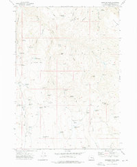
2011 Map of Juntura
USGS Topo · Published 2011About this map
The Malheur River winds through this high desert landscape, serving as the primary geographic anchor for the settlement of Juntura. This area represents a critical ranching and transit hub in Malheur County, where the river valley supports agricultural infrastructure like the Townsite Ditch and Allen Ditch. The presence of the Juntura Post Office, Juntura Cemetery, and Juntura Airstrip concentrated in the northern portion of the map indicates the community's role as a local center for commerce and services.
Find a feature on this map
50 named features on this map. Tap any name to fly to it.
Don’t see what you’re looking for? This feature index may not catch every label — zoom into the map to look around manually.
Map Details
Editions of this 2011 Juntura Map
This is the sole edition of this map. No revisions or reprints were ever made.
Other maps of this area

1955 · Burns
USGS Topo · 1:250,000

1955 · Boise
USGS Topo · 1:250,000

1958 · Burns
USGS Topo · 1:250,000

1958 · Boise
USGS Topo · 1:250,000

1959 · Burns
USGS Topo · 1:250,000

1962 · Boise
USGS Topo · 1:250,000

1966 · Westfall Butte
USGS Topo · 1:62,500

1966 · Beulah
USGS Topo · 1:62,500

1972 · Shumway Reservoir
USGS Topo · 1:24,000
1972 · Monument Peak
USGS Topo · 1:24,000