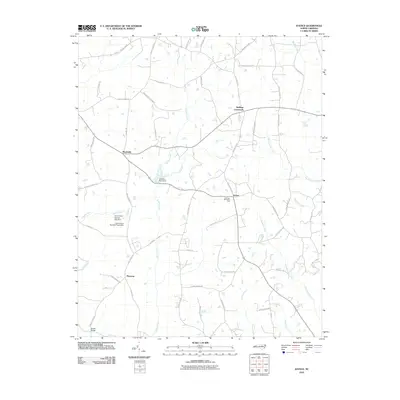
2010 Map of Justice
USGS Topo · Published 2010About this map
Justice and Stallings Crossroads serve as the primary focal points of this rural landscape in Franklin County, defined by a dense network of local roads and watercourses. The area is characterized by family-named landmarks and infrastructure, such as Stallings Memorial Park and Farrell Bridge, reflecting a community deeply rooted in its local geography. The drainage pattern is intricate, with Cypress Creek and Long Branch feeding into larger systems, while the presence of Jacksons Pond Dam and multiple structures like Harris Pond Number Two Dam indicate historical water management for local use.
Find a feature on this map
57 named features on this map. Tap any name to fly to it.
Don’t see what you’re looking for? This feature index may not catch every label — zoom into the map to look around manually.
Map Details
Editions of this 2010 Justice Map
This is the sole edition of this map. No revisions or reprints were ever made.
Other maps of this area

1902 · Spring Hope
USGS Topo · 1:62,500

1904 · Springhope
USGS Topo · 1:62,500

1953 · Raleigh
USGS Topo · 1:250,000

1953 · Greensboro
USGS Topo · 1:250,000

1954 · Greensboro
USGS Topo · 1:250,000

1954 · Raleigh
USGS Topo · 1:250,000

1962 · Greensboro
USGS Topo · 1:250,000

1966 · Greensboro
USGS Topo · 1:250,000

1968 · Bunn West
USGS Topo · 1:24,000
1978 · Bunn East
USGS Topo · 1:24,000