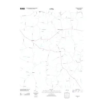
2013 Map of Justice
USGS Topo · Published 2013About this map
Stallings Crossroads and the surrounding rural landscape of Franklin County are defined by a network of creeks and small family-named settlements. The geography is dominated by the northern flow of Cypress Cr and the winding course of the Tar River in the southwest corner near Farrell Bridge. These water bodies and their tributaries, such as Big Peachtree Cr and Jumping Run, dictate the placement of local roads and the small clusters of homes at Mapleville, Justice, and Margaret.
Find a feature on this map
79 named features on this map. Tap any name to fly to it.
Don’t see what you’re looking for? This feature index may not catch every label — zoom into the map to look around manually.
Map Details
Editions of this 2013 Justice Map
This is the sole edition of this map. No revisions or reprints were ever made.
Other maps of this area

1902 · Spring Hope
USGS Topo · 1:62,500

1904 · Springhope
USGS Topo · 1:62,500

1953 · Raleigh
USGS Topo · 1:250,000

1953 · Greensboro
USGS Topo · 1:250,000

1954 · Greensboro
USGS Topo · 1:250,000

1954 · Raleigh
USGS Topo · 1:250,000

1962 · Greensboro
USGS Topo · 1:250,000

1966 · Greensboro
USGS Topo · 1:250,000

1968 · Bunn West
USGS Topo · 1:24,000
1978 · Bunn East
USGS Topo · 1:24,000