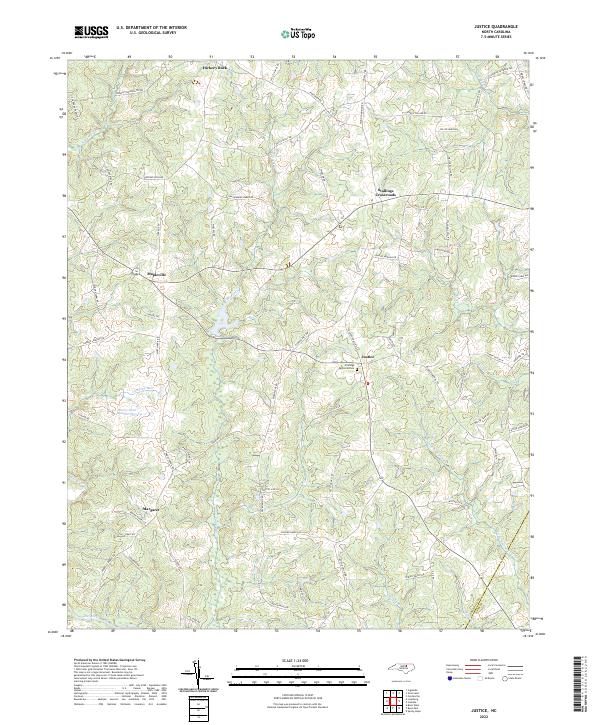
2022 Map of Justice
USGS Topo · Published 2022About this map
Stallings Crossroads and the surrounding rural communities of Justice and Mapleville anchor this portion of the coastal plain, where the landscape is defined by the winding course of the Tar River and its numerous tributaries. Small settlements such as Hickory Rock and Margaret are connected by a network of family-named roads, including Ronald Tharrington Rd and Earlie Collins Rd, reflecting the deep-rooted agricultural heritage of the region. The map highlights the transition of local hydrology through features like Cypress Cr and Jumping Run, which feed into larger water bodies such as Harris Pond Number Two. This documentation captures the area at a point of continued rural character, evidenced by the preservation of naming conventions that tie the land to its long-standing resident families and local landmarks like Stallings Memorial Park.
Find a feature on this map
76 named features on this map. Tap any name to fly to it.
Don’t see what you’re looking for? This feature index may not catch every label — zoom into the map to look around manually.
Map Details
Editions of this 2022 Justice Map
This is the sole edition of this map. No revisions or reprints were ever made.
Other maps of this area

1902 · Spring Hope
USGS Topo · 1:62,500

1904 · Springhope
USGS Topo · 1:62,500

1953 · Raleigh
USGS Topo · 1:250,000

1953 · Greensboro
USGS Topo · 1:250,000

1954 · Greensboro
USGS Topo · 1:250,000

1954 · Raleigh
USGS Topo · 1:250,000

1962 · Greensboro
USGS Topo · 1:250,000

1966 · Greensboro
USGS Topo · 1:250,000

1968 · Bunn West
USGS Topo · 1:24,000
1978 · Bunn East
USGS Topo · 1:24,000