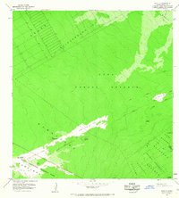
1966 Map of Kalalua
USGS Topo · Published 1967About this map
Hawaii Volcanoes National Park and the Puna Forest Reserve dominate this mid-1960s survey, documenting a landscape in a state of constant geomorphic change. The map provides a critical record of recent volcanic activity, specifically delineating the Lava Flow of 1965, the Lava Flow of 1963, and the Lava Flow of 1961. These flows cut across the forested slopes of Kahaualea and Kapaahu, illustrating how fresh basalt has historically reshaped the Puna District.
Find a feature on this map
23 named features on this map. Tap any name to fly to it.
Don’t see what you’re looking for? This feature index may not catch every label — zoom into the map to look around manually.
Map Details
Editions of this 1966 Kalalua Map
This is the sole edition of this map. No revisions or reprints were ever made.
Other maps of this area

1917 · Hilo
USGS Topo · 1:62,500

1922 · Puna
USGS Topo · 1:62,500

1924 · Makuu
USGS Topo · 1:62,500

1924 · Puna
USGS Topo · 1:62,500

1924 · Kalapana
USGS Topo · 1:62,500

1932 · Hilo
USGS Topo · 1:62,500

1954 · Hawaii South
USGS Topo · 1:250,000

1954 · Hawaii North
USGS Topo · 1:250,000

1959 · Hawaii South
USGS Topo · 1:250,000

1959 · Hawaii North
USGS Topo · 1:250,000