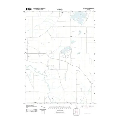
2011 Map of Kalamazoo NE
USGS Topo · Published 2011About this map
The Kalamazoo River and its various tributaries define the lowlands of Allegan County in this 2011 survey. The landscape is marked by a blend of agricultural parcels and small residential clusters around Neeley, Doster, and Cooper. Hydrographic features are prominent throughout the quadrangle, including the winding course of the Gun River and several significant water bodies like Pine Lake and the developed shoreline of Lake Doster.
Find a feature on this map
80 named features on this map. Tap any name to fly to it.
Don’t see what you’re looking for? This feature index may not catch every label — zoom into the map to look around manually.
Map Details
Editions of this 2011 Kalamazoo NE Map
This is the sole edition of this map. No revisions or reprints were ever made.
Other maps of this area

1916 · Kalamazoo
USGS Topo · 1:62,500

1918 · Kalamazoo
USGS Topo · 1:62,500

1918 · Galesburg
USGS Topo · 1:62,500

1943 · Kalamazoo
USGS Topo · 1:62,500

1944 · Galesburg
USGS Topo · 1:62,500

1947 · Delton
USGS Topo · 1:24,000

1947 · Galesburg
USGS Topo · 1:24,000

1947 · Galesburg
USGS Topo · 1:62,500

1950 · Galesburg
USGS Topo · 1:62,500

1951 · Hastings
USGS Topo · 1:62,500