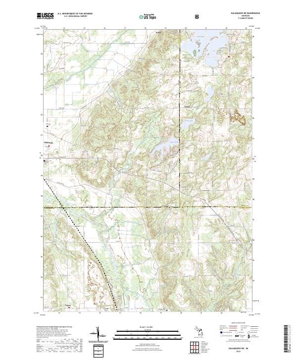
2023 Map of Kalamazoo NE
USGS Topo · Published 2023About this map
The Kalamazoo River and its tributary Gun River define the drainage of this Michigan landscape where Allegan, Barry, and Kalamazoo counties meet. In the northern section, Neeley and Doster sit near the southern reaches of the Manistee National Forest, while the settlement of Plainwell occupies the western edge near Hillside Cem and Ives Cem. The map illustrates a shift from the agrarian north toward the suburban development of Cooper in the south, characterized by an organized grid of section-line roads like 110th Ave and E Baseline Rd. Local aviation history is grounded at Walker Airport near the center of the sheet. Natural water features including Pine Lake, Silver Lake, and Lake Doster punctuate the terrain, showing the region's characteristic mixture of glacial wetlands and modern residential expansion around the water.
Find a feature on this map
66 named features on this map. Tap any name to fly to it.
Don’t see what you’re looking for? This feature index may not catch every label — zoom into the map to look around manually.
Map Details
Editions of this 2023 Kalamazoo NE Map
This is the sole edition of this map. No revisions or reprints were ever made.
Other maps of this area

1916 · Kalamazoo
USGS Topo · 1:62,500

1918 · Kalamazoo
USGS Topo · 1:62,500

1918 · Galesburg
USGS Topo · 1:62,500

1943 · Kalamazoo
USGS Topo · 1:62,500

1944 · Galesburg
USGS Topo · 1:62,500

1947 · Delton
USGS Topo · 1:24,000

1947 · Galesburg
USGS Topo · 1:24,000

1947 · Galesburg
USGS Topo · 1:62,500

1950 · Galesburg
USGS Topo · 1:62,500

1951 · Hastings
USGS Topo · 1:62,500
Featured Places
- Plainwell, MI
- Richland Township, MI
- Cooper Charter Township, MI
- Gun Plain Charter Township, MI
- Doster, MI