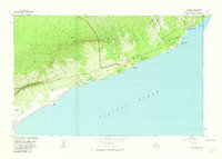
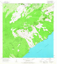
1981 Map of Kalapana
USGS Topo · Published 1981About this map
Hawaii Volcanoes National Park dominates this coastal landscape, where the geological volatility of the Puna District is clearly recorded. The map documents significant recent activity, specifically the Lava Flow of 1977 and the older Lava Flow of 1750, which have reshaped the terrain near Kalapana and Kaimu. This survey provides a vital record of the coastline before major eruptions in the following decade altered the geography forever, including the proximity of settlements like Kapsahu and Punahaha to the encroaching flows. Cultural sites are prevalent throughout the park and coastal strip, ranging from the Petroglyphs Puuloa to numerous ancient temples such as Wahaula Heiau and Kekaloa Heiau. Along the shore, landmarks like Queens Bath and the Cave of Refuge highlight the intersection of natural volcanic features and Hawaiian heritage, connected by the Chain of Craters Road and the Puna Coast Trail.
Find a feature on this map
57 named features on this map. Tap any name to fly to it.
Don’t see what you’re looking for? This feature index may not catch every label — zoom into the map to look around manually.
Map Details
Editions of this 1981 Kalapana Map
2 editions found
Other maps of this area

1922 · Puna
USGS Topo · 1:62,500

1924 · Puna
USGS Topo · 1:62,500

1924 · Kalapana
USGS Topo · 1:62,500

1954 · Hawaii South
USGS Topo · 1:250,000

1959 · Hawaii South
USGS Topo · 1:250,000

1961 · Hawaii South
USGS Topo · 1:250,000

1962 · Hawaii South
USGS Topo · 1:250,000
1963 · Volcano
USGS Topo · 1:24,000
1963 · Makaopuhi Crater
USGS Topo · 1:24,000
1966 · Pahoa South
USGS Topo · 1:24,000