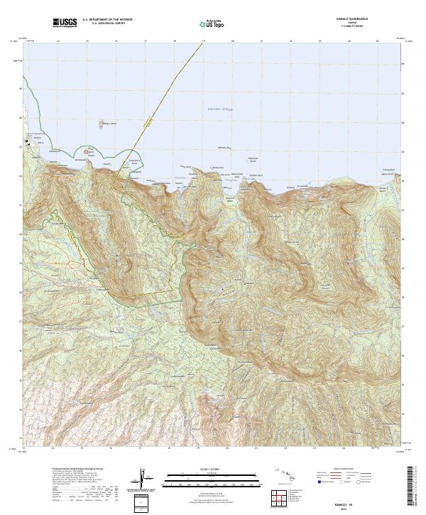
2024 Map of Kamalo
USGS Topo · Published 2024About this map
Kalaupapa National Historical Park dominates this coastal landscape on the northern shore of Molokai, marking a site of deep historical significance. The map details the transition from the secluded peninsula to the sheer, dramatic cliffs that drop into Pelekunu Bay and the Wailau Valley. Cultural markers such as the Siloama Congregational Church, Kalawao Cem, and Makaliȩi Cem reflect the area’s unique heritage as a place of isolation and community. The terrain is defined by extreme vertical relief, including some of the world's highest sea cliffs, where Haloku Falls and Oloȩupena Falls plunge toward the Pacific Ocean. This modern survey reveals a network of ancient stream beds and ridges, from Puȩukaȩua-Meaula Ridge to Kukuinui Ridge, documenting the complex topography and enduring isolation of these coastal reaches.
Find a feature on this map
155 named features on this map. Tap any name to fly to it.
Don’t see what you’re looking for? This feature index may not catch every label — zoom into the map to look around manually.
Map Details
Editions of this 2024 Kamalo Map
This is the sole edition of this map. No revisions or reprints were ever made.
Other maps of this area

1952 · Halawa
USGS Topo · 1:24,000

1952 · Kamalo
USGS Topo · 1:24,000

1952 · Kaunakakai
USGS Topo · 1:24,000

1954 · Maui
USGS Topo · 1:250,000

1966 · Maui
USGS Topo · 1:250,000

1967 · Kaunakakai
USGS Topo · 1:24,000

1968 · Halawa
USGS Topo · 1:24,000
1968 · Kamalo
USGS Topo · 1:24,000

1974 · Maui
USGS Topo · 1:250,000
1983 · Molokai East
USGS Topo · 1:25,000