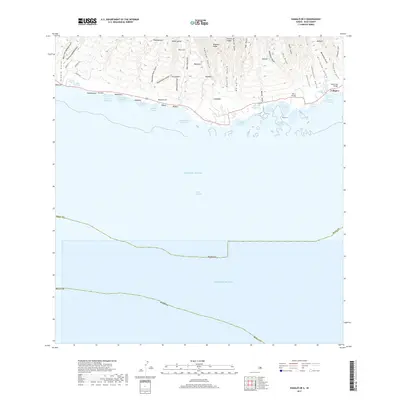
2017 Map of Kamalo OE S
USGS Topo · Published 2017About this map
Traditional Hawaiian aquaculture dominates the coastline of southern Moloka‘i in this 2017 survey. The shore is defined by a dense concentration of ancient fishponds, including the notable Kakahai‘a Fishpond, Kamāhu‘ehu‘e Fishpond, and ‘Ualapu‘e Fishpond. These features reveal a landscape deeply integrated with the sea, where small settlements like ‘Ualapu‘e, Nalulua, and Pāhoa sit at the foot of dramatic ridges and gulches.
Find a feature on this map
66 named features on this map. Tap any name to fly to it.
Don’t see what you’re looking for? This feature index may not catch every label — zoom into the map to look around manually.
Map Details
Editions of this 2017 Kamalo OE S Map
This is the sole edition of this map. No revisions or reprints were ever made.
Other maps of this area

1923 · Island of Lanai
USGS Topo · 1:31,680

1925 · Island of Lanai
USGS Topo · 1:62,500

1952 · Halawa
USGS Topo · 1:24,000

1952 · Kamalo
USGS Topo · 1:24,000

1952 · Kaunakakai
USGS Topo · 1:24,000

1954 · Maui
USGS Topo · 1:250,000

1966 · Maui
USGS Topo · 1:250,000

1967 · Kaunakakai
USGS Topo · 1:24,000

1968 · Halawa
USGS Topo · 1:24,000
1968 · Kamalo
USGS Topo · 1:24,000